Education
Geospatial Analysis
Data Wrangling
Python
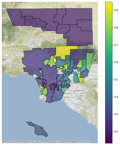
This project built a custom dataset by merging sources from the California Department of Education and the LA GeoHub to analyze SAT performance across Los Angeles County school districts.
The focus was on the percentage of 11th and 12th graders who met the benchmark in both Evidence-Based Reading & Writing (ERW) and Math — mapped spatially across the county to surface patterns tied to place.